Image Credit & Copyright:
Göran Strand
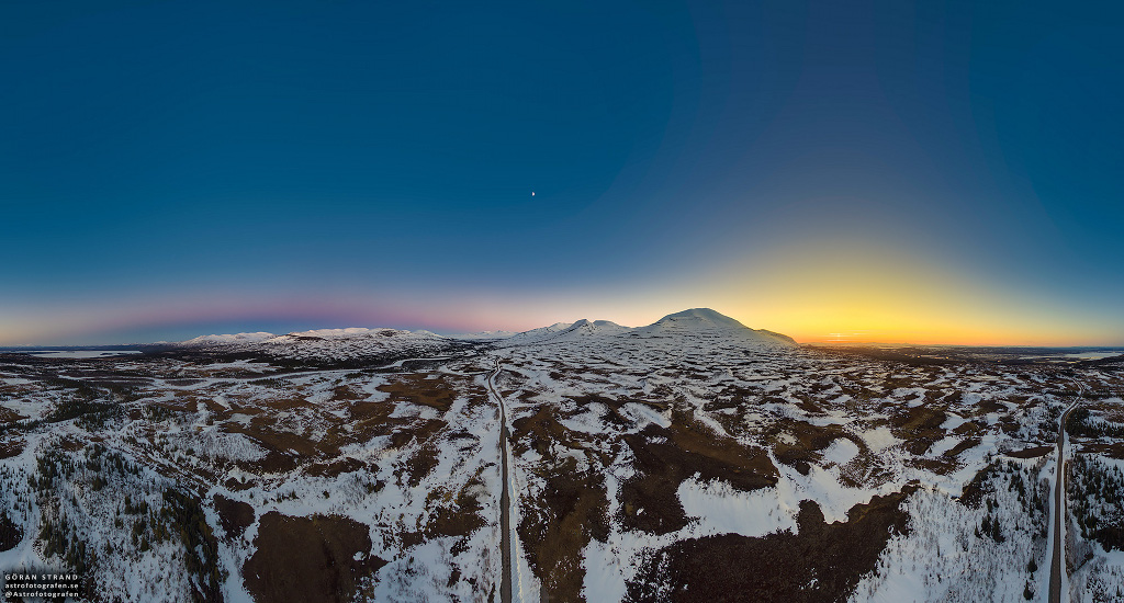
Explicație: Urmărirea drumului prin această
panoramă de 360 grade, tranversează o zonă montană îndepărtată, din Jämtland, în
Suedia, de pe Planeta noastră, Pământ. Un mozaic de fotografii statice, în
formatul de 3 X 8, astfel, panorama a fost realizată pe data de 3 Mai,
utilizând o mică dronă, situată la înălţimea de două sute de metrii, deasupra
solului. Scena, înregistrează lumina caldă a Soarelui, care se află în partea
de Nord-Vest și umbra întunecată a Planetei noastre, Pământ, care se ridică în partea
de Sud-Est. Un mic stâlp de Soare, conferă poziția Soarelui, chiar sub orizont,
în timp ce, arcul sau centura lui Venus, prezentat în culoarea
roz-crepusculară, conturează umbra Planetei noastre, Pământ. Remarcabil de
clar, în mijlocul cerului, se află luneta primului sfert, care este vizibilă
deasupra munților, la jumătatea discului iluminat, care separă apusul și
răsăritul Soarelui. O serie de expuneri au fost combinate, cu scopul de acoperire
a diferenței de luminozitate a cerului, pentru apusul Soarelui și pământ. Cel
mai înalt vârf, al apusului este Storsnasen, situat la aproximativ 1'400 de metrii, deasupra nivelului mării.
Traducerea şi
adaptarea textului, din limba engleză, în limba română: Laurenţiu - Flaviu
Sima, din România.
Explanation: The road tracking through this stunning 360 degree view crosses a remote mountain area of Jämtland, Sweden, planet Earth. A 3x8 mosaic of still images, the panorama was taken on May 3rd from a small drone 200 meters above the ground. The scene records the warm light of the Sun setting in the northwest and the planet's dark shadow rising in the southeast. A small sun pillar gives away the Sun's position just below the horizon while the pinkish anti-twilight arch or belt of Venus outlines Earth's shadow. In the middle of the remarkably clear sky, the First Quarter Moon is visible above the mountains, its half illuminated disk separating sunset and shadowrise. A range of exposures were combined to cover the difference in sky brightness for sunset and Earth shadow. The tallest peak left of the sunset is Storsnasen, some 1400 meters above sea level.
Sursa
(source): https://apod.nasa.gov/apod/ap170601.html
Articolul original, în limba engleză
Shadowrise and Sunset
Articolul original, în limba engleză
Shadowrise and Sunset
Explanation: The road tracking through this stunning 360 degree view crosses a remote mountain area of Jämtland, Sweden, planet Earth. A 3x8 mosaic of still images, the panorama was taken on May 3rd from a small drone 200 meters above the ground. The scene records the warm light of the Sun setting in the northwest and the planet's dark shadow rising in the southeast. A small sun pillar gives away the Sun's position just below the horizon while the pinkish anti-twilight arch or belt of Venus outlines Earth's shadow. In the middle of the remarkably clear sky, the First Quarter Moon is visible above the mountains, its half illuminated disk separating sunset and shadowrise. A range of exposures were combined to cover the difference in sky brightness for sunset and Earth shadow. The tallest peak left of the sunset is Storsnasen, some 1400 meters above sea level.

Niciun comentariu:
Trimiteți un comentariu